SPECIAL PROJECTS
The Missing Lynx
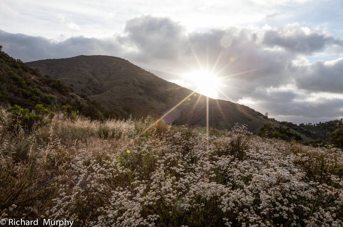
Connecting wildlands is crucial for wildlife, especially large mammals like mule deer (Odocoileus heminus) and mountain lions (Puma concolor), which typically have home ranges of more than 100 square miles. Successful wildlife corridors provide access to food and other resources, while also improving genetic variation. Connecting breeding populations of a species increases their ability to adapt to their changing environment, which is especially important as we begin to witness the effects of climate change. We developed the Save 1000 Acres campaign to protect important cornerstone properties. Now, we shift our focus to connecting those properties so animals can move freely between preserved areas.
With mountain lions struggling to find mates as their habitat diminishes, and the California gnatcatcher (Polioptila californica) now on the endangered species list, we are thrilled to welcome them on our preserves—along with bobcats (Lynx rufus), coyotes (Canis latrans), barn owls (Tyto alba), great blue herons (Ardea herodias), and more! Conservation of these animals is possible, but it requires protecting more land by creating safe passageways between preserved lands, so animals can live without conflict with humans.
For The Missing Lynx campaign, the Conservancy has prioritized land acquisitions in areas that are contiguous to other preserved lands in the Escondido Creek watershed. With your help, we can protect and preserve these “missing lynx” that are vital to the success of our native species so they can live, and live wild.
Click here to see updates and find out how you can help.

Save 1000 Acres
The Conservancy launched the Save 1000 Acres campaign with a big idea—to create a 9+ mile habitat corridor extending from Highway 15 to Bear Valley, and beyond, so that wildlife can roam freely and forever thrive across North San Diego County. As more natural spaces have become increasingly fragmented by human development and wildlife adapt to climate change, protecting viable habitat for animals to migrate through has become more important than ever. Connecting open spaces allows these animals to transit to meet their basic needs for breeding, shelter, and food.
A big idea requires partners with a shared vision, so the Conservancy teamed up with the Palomar Audubon Society, the Friends of Daley Ranch, San Diego County Parks and Recreation, the U.S. Navy, the State of California, Marine Corps Camp Pendleton and hundreds of supporters, including the San Pasqual Band of Mission Indians, and donors to the Save 1000 Acres campaign.
Thanks to all the support, the Save 1000 Acres campaign raised more than $11 million over the last four years to protect these 975 acres in perpetuity.
The Conservancy received wildlife habitat protection grant funds from the California Wildlife Conservation Board and the California Natural Resources Agency to acquire the George Sardina, MD Preserve. As the Conservancy nears their 1,000-acre goal, they are seeking additional donations to acquire and preserve key lands between the newly protected properties, further strengthening wildlife corridors in San Diego County.
Grape Day Park
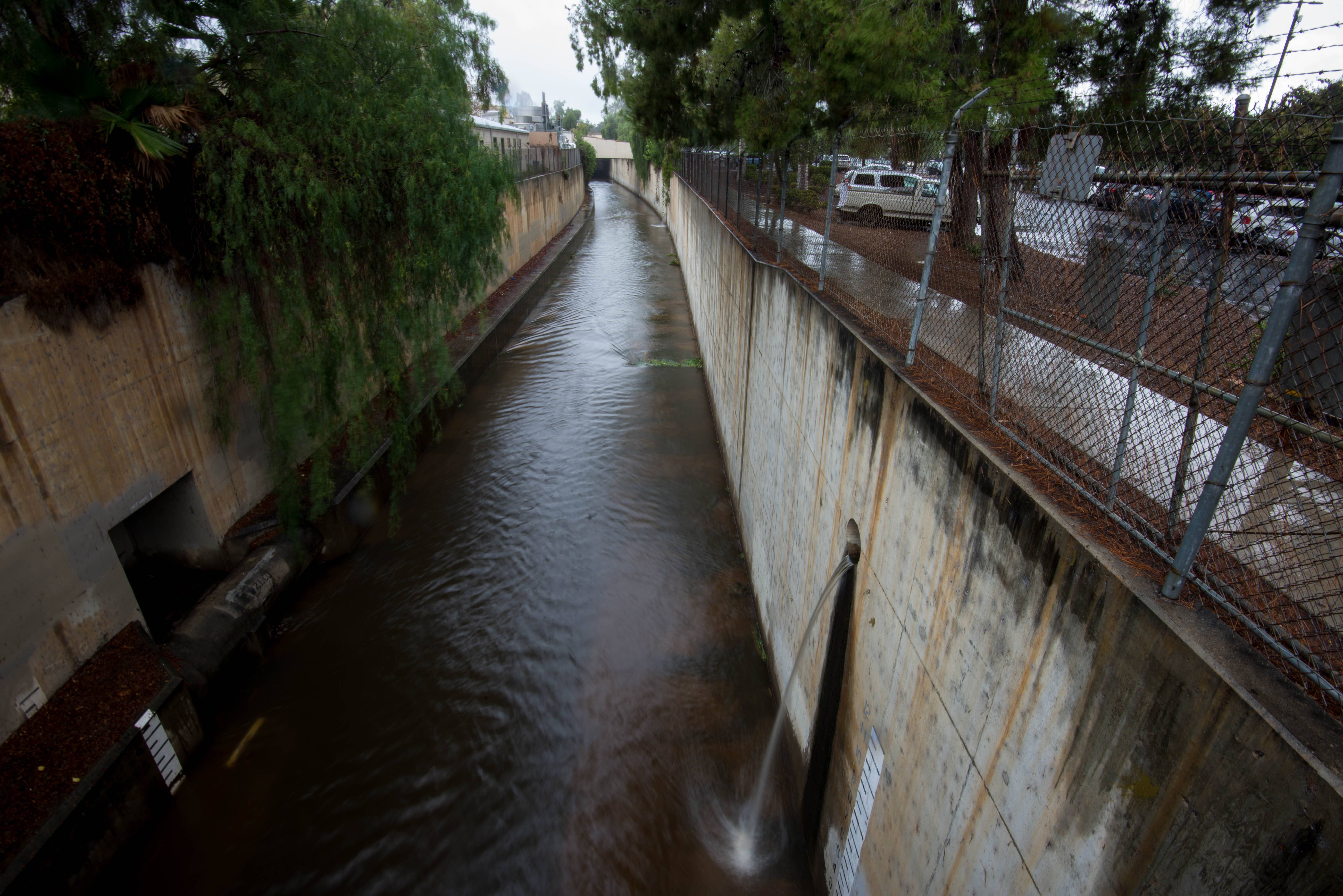
Not all of our work is in the wild lands. Bringing natural beauty and economic opportunity to urban areas along Escondido Creek in the city of Escondido is also important. In fact, greening Escondido improves the chances that the natural areas we protect will successfully support wildlife for decades to come. With that in mind, the Conservancy sought and won a grant of $355,000 from the State of California Integrated Regional Water Management Program to develop preliminary designs (30% design level) to restore Escondido Creek through Grape Day Park.
This goal: create an engineered design for a pilot project to illustrate how the 6+-mile concrete flood control channel could look and function if restored. The 30% design level is considered a significant engineering milestone, as it enables the larger project costs to be estimated once a design is rendered to 30%.
Please click here for full project proposal:

Water Quality
A 2007 Surface Water Ambient Monitoring Program (SWAMP) Report for the Carlsbad Watershed revealed the Escondido Creek to be in poor ecological condition. Water quality tests showed that the creek had low levels of toxicity, impaired aquatic life and compromised beneficial use (such as recreation) due to high bacteria levels following storms. Without clean and free flowing water in the creek and its tributaries, the Escondido Creek watershed will never fulfill its potential to support the natural diversity of species that make our region unique.
Over the years, numerous agencies and special interest groups have conducted water quality testing on various sections of Escondido Creek. Although these tests have provided useful information, they have not always been conducted regularly at the same locations. Beginning in September, 2011, the Conservancy began conducting routine water quality monitoring at four sites along the Escondido Creek. The purpose of the Water Quality Monitoring Program is to establish a baseline that will be used to evaluate the condition and overall health of Escondido Creek on an ongoing basis, as well as to identify short- and long-term trends.
Water quality parameters that are monitored by the Conservancy’s Water Quality Monitoring Program include the following:
- Alkalinity – how well the water can neutralize acidic pollution
- Ammonia – a component of fertilizer that serves as a nutrient for plant growth, but can also be toxic
- Dissolved Oxygen – oxygen that has been dissolved into the water and is necessary for aquatic organisms to breathe
- Nitrate – a nutrient for plant growth that may cause excessive algae growth when present in higher than normal quantities
- Nitrite – an extremely toxic nitrogen compound
- pH – a measure of the acidity of the water
- Phosphate – a nutrient for plant growth that may cause excessive algae growth when present in higher than normal quantities
- Temperature – an important determinant of whether or not certain organisms can survive in the creek
Many of these water quality parameters have improved since monitoring began, but there is still much more work to be done. The natural creek (as opposed to the concrete flood control channel in downtown Escondido) acts as a biofilter, removing pollutants from the creek as it progresses toward the ocean. One of the Conservancy’s long-term goals is to re-naturalize this concrete channel in order to provide greater benefits to both people and wildlife.
If you are interested in volunteering to help with water quality testing or if you want to learn more about our Water Quality Monitoring Program, please contact us.
Fire Recovery
On May 14, 2014 the Cocos Fire in north San Diego County scorched 1,995 acres and destroyed 36 homes in San Marcos and the Harmony Grove region of Escondido. The massive arson fire began as a small ember, which was started in the backyard of a Washingtonia Avenue home. In addition to the significant loss of property and other human impacts, the fire also wreaked havoc on habitats and wildlife.
As part of the Conservancy’s commitment to land management within the Escondido Creek watershed, we are monitoring how different habitat types are recovering in the wake of the Cocos Fire. Part of this entails a visual documentation of representative habitat types. Every month we send out our volunteer amateur photographers to consistently capture pictures of affected grassland, oak woodland, chaparral, and riparian sites. This effort is a five-year project that will continue until May 2019. At the end of the project the Conservancy will create a time-lapse video, comprised of all the photos taken at each site, which will visualize how that area is recovering. In the meantime, you can follow the progress of this project here. We will be posting the most up-to-date before-and-after photos for each location regularly. The project will be used to help us monitor which native plant species are recovering naturally and which may require additional assistance due to severe ecological degradation. We also commissioned a study to access ecological damage in the area.

